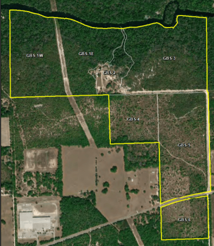
The park is separated into management zones, which outline locations on the ground used to reference management actions. The shape and size of each zone may be determined by the type of natural community, the burn zone, and the location of existing roadways and natural fire breaks. It is crucial to highlight that while all burn zones are management zones, not all management zones feature fire-dependent natural ecosystems.
Description and Evaluation
The park's topography
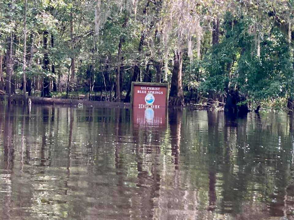
The park is situated in the geomorphologic zone of the Gulf Coastal Lowlands, more specifically in the Suwannee River Lowlands (White 1970). The Gulf Coastal Lowlands are described as gently sloping terraces that extend from the highlands to the coast. Throughout most of this region, limestone is at or near the surface, with sand or sandy clay on top. The elevation of the park ranges from 20 feet at the Santa Fe River on the north boundary to approximately 75 feet above mean sea level (msl) on the south boundary. The ground rises from the Santa Fe floodplain to the uplands to the south. The Suwannee River Water Management District (SRWMD) determined the 100-year floodplain (base flood elevation) for the Gilchrist Blue Springs section of the Santa Fe River at 38.4 feet based on NAVD88.
The park’s natural topography has been altered in some ways. The most visible changes are the massive powerline easement that cuts across the park’s western side, the park entrance road, parking area, and terraced portions on the hills above the main spring boil.
In zones GBS-4, GBS-5, and GBS-6, there are only minor disturbances linked with former old fields and pine plantations. Prior to pine planting in the 1990s, minor furrowing appears to have happened in the old fields in the SW area of zone GBS-5 and the NW area of zone GBS-6. Because of the paucity of site preparation activities outside of the old field areas, native sandhill groundcover remains in the remaining uplands despite pine planting. In zone GBS-1e, there is also a borrow pit along the powerline, as well as multiple deep gouges along the powerline where sand has been extracted.
Gilchrist Blue Springs State Park has six different types of soil. There are obvious signs that erosion and sedimentation have impacted several localised areas, including the entire upslope terrace around the Gilchrist Blue main headspring, the boil and spring run of both Gilchrist Blue and Naked springs, the campground, the main entrance road, and along the western powerline easement.
Due to extensive trampling from foot and vehicle traffic, flora on the slopes above the major headspring is almost non-existent, and soil erosion is prevalent.
Numerous exposed wooden beams are buried throughout the spring bowl’s steep slopes, which appear to have been intentionally constructed for soil stabilisation, including a massive wooden retaining wall around the majority of the main headspring. Unfortunately, the surface terraces in the main spring basin do not moderate stormwater flow sufficiently to prevent significant soil erosion and sedimentation. Furthermore, exposed roots from numerous enormous trees distributed across the main spring bowl, as well as the wooden timbers, might be tripping hazards.
Visual observation of current conditions and an examination of old pictures reveal that extensive erosion and sedimentation has occurred within Gilchrist Blue Spring and Naked Spring, as well as their related spring run streams, throughout the years.
Vast erosion can be seen at the bottom of Gilchrist Blue Spring, with significant regions completely free of submerged aquatic vegetation (SAV) and the presence of a wide, deep, bare soil trench that runs the whole length of the spring flow stream out to the Santa Fe River mouth. Swimming and wading likely contribute to erosion and SAV consequences on the spring-run bottom, particularly when water levels are low.
The park is located in the Gulf Coastal Lowlands, more especially along the Lower Santa Fe River (SRWMD 2013). The Gulf Coastal Lowlands are a large karst plain with exposed surface limestone, sinkholes, and internally drained swallet wetlands.
The Gilchrist Blue Springs State park contains a number of limestone outcrops. The underlying limestone in this region has been subjected to substantial solution activity, resulting in surface features typical of karst topography. The collapse of the upper layers of soil and mineral components into underlying solution voids and caverns generated surface features such as sinkholes, springs, and swallet depressions.
Bell Ridge, Brooksville Ridge, Waccasassa Flats, and High Springs Gap are other significant physiographic landscape features (Williams et al. 1977; Upchurch et al. 2011). The Bell and Brooksville Ridges are Pleistocene-age beach dunes that cut Gilchrist County from north to south. They are composed of sandy overburden underlain by clastic Miocene deposits and have much higher elevations and very limited surface drainage (Puri and Vernon 1964; Col et al. 1997). The Bell Ridge straddles the Waccasassa Flats, which are both distinguished by a perched water table and a plethora of surface wetlands. The Santa Fe River flows through this valley region, and the High Springs Gap is a low area between these peaks.
Though no mining is known to have taken place in the park, limestone is quarried in the surrounding area for use as road base material. It is unknown whether commercially valuable mineral deposits exist in the park.