
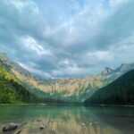
Introduction of Olallie State Park
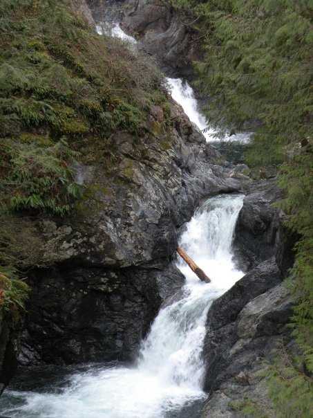
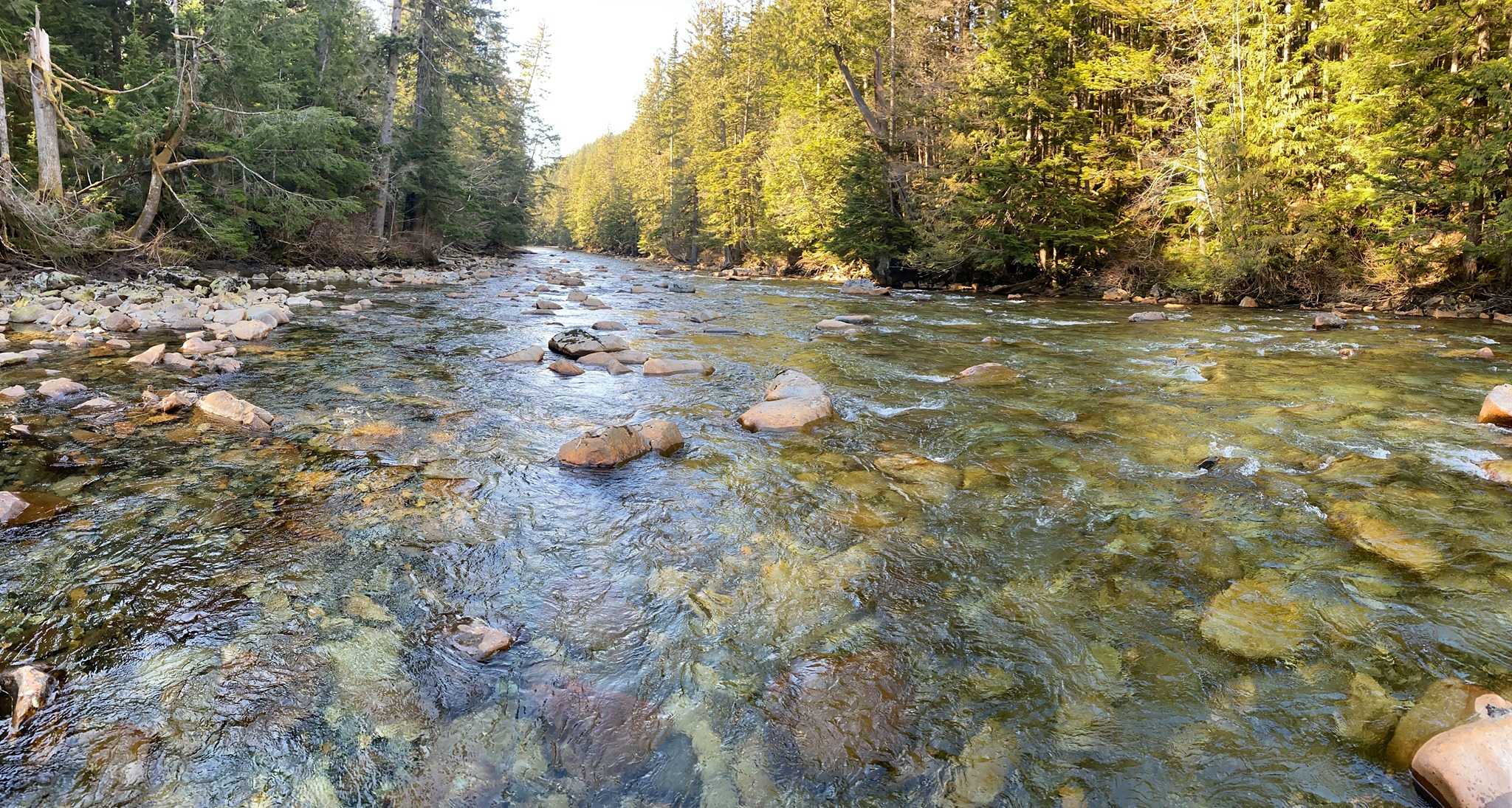
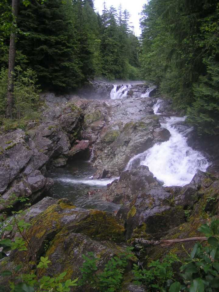
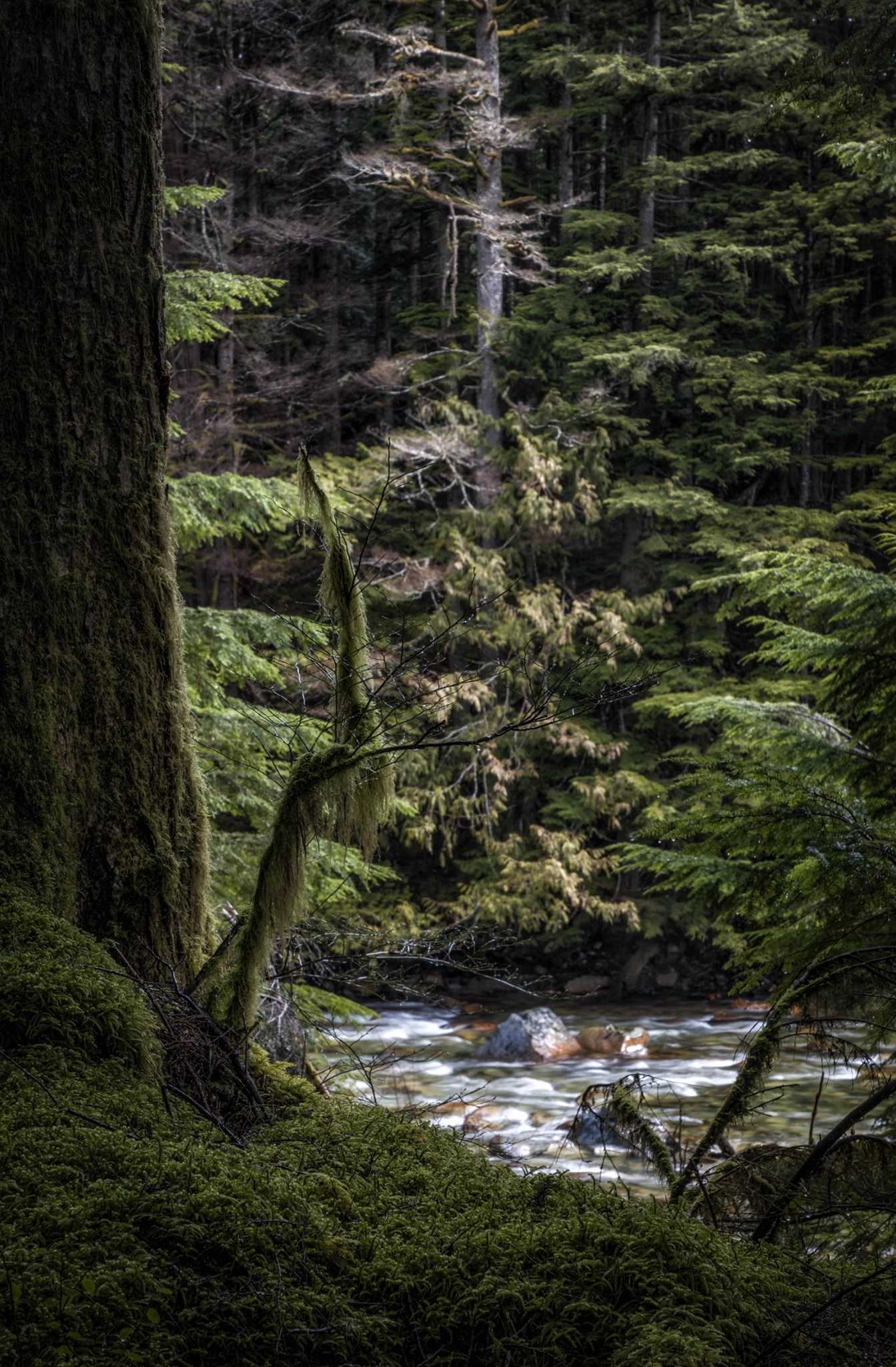
A public leisure area with several waterfalls, Olallie State Park is five miles southeast of North Bend, Washington. Along the South Fork of the Snoqualmie River, the state park extends over 3.5 miles. The park’s 135-foot-tall Twin Falls is its most notable feature.
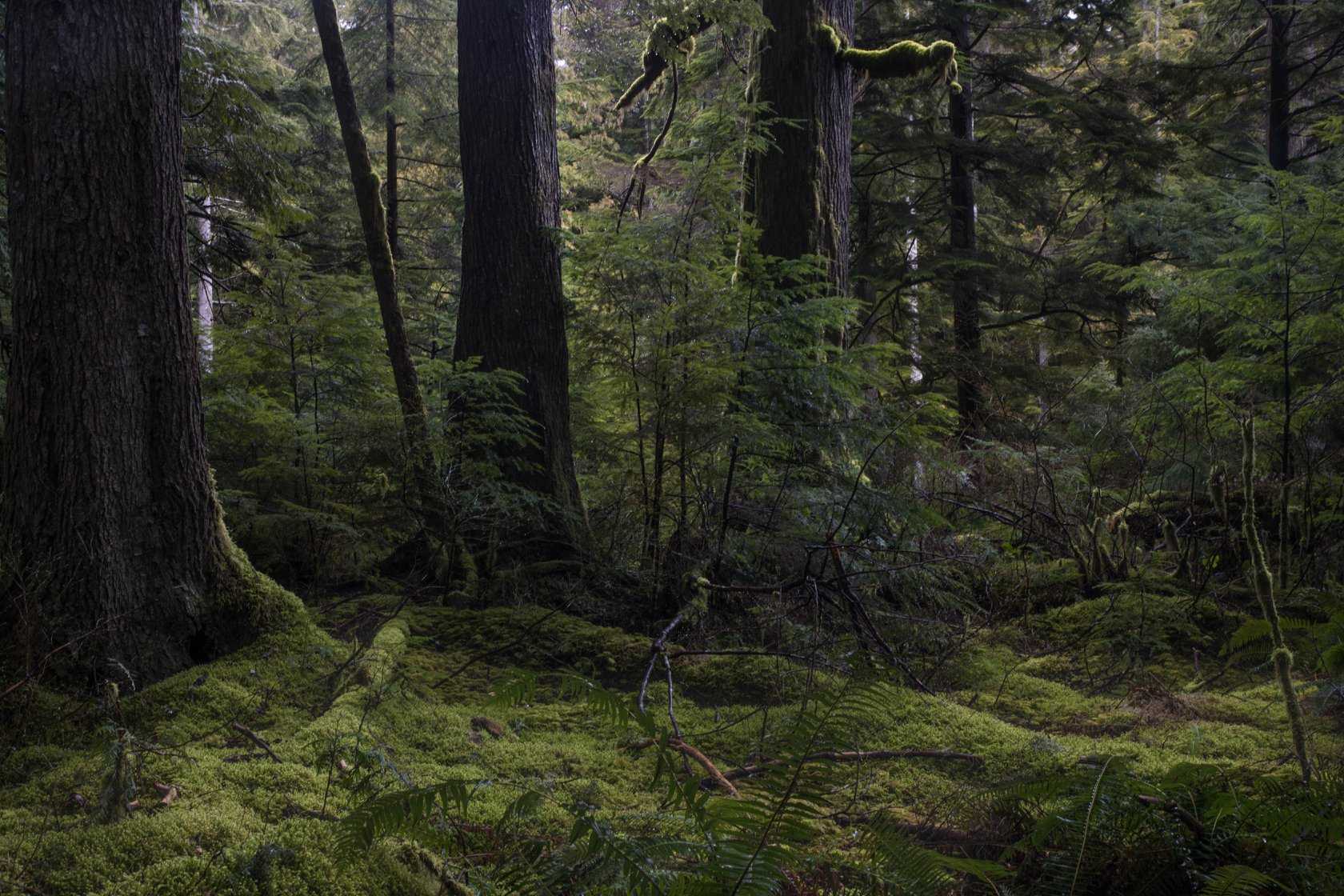
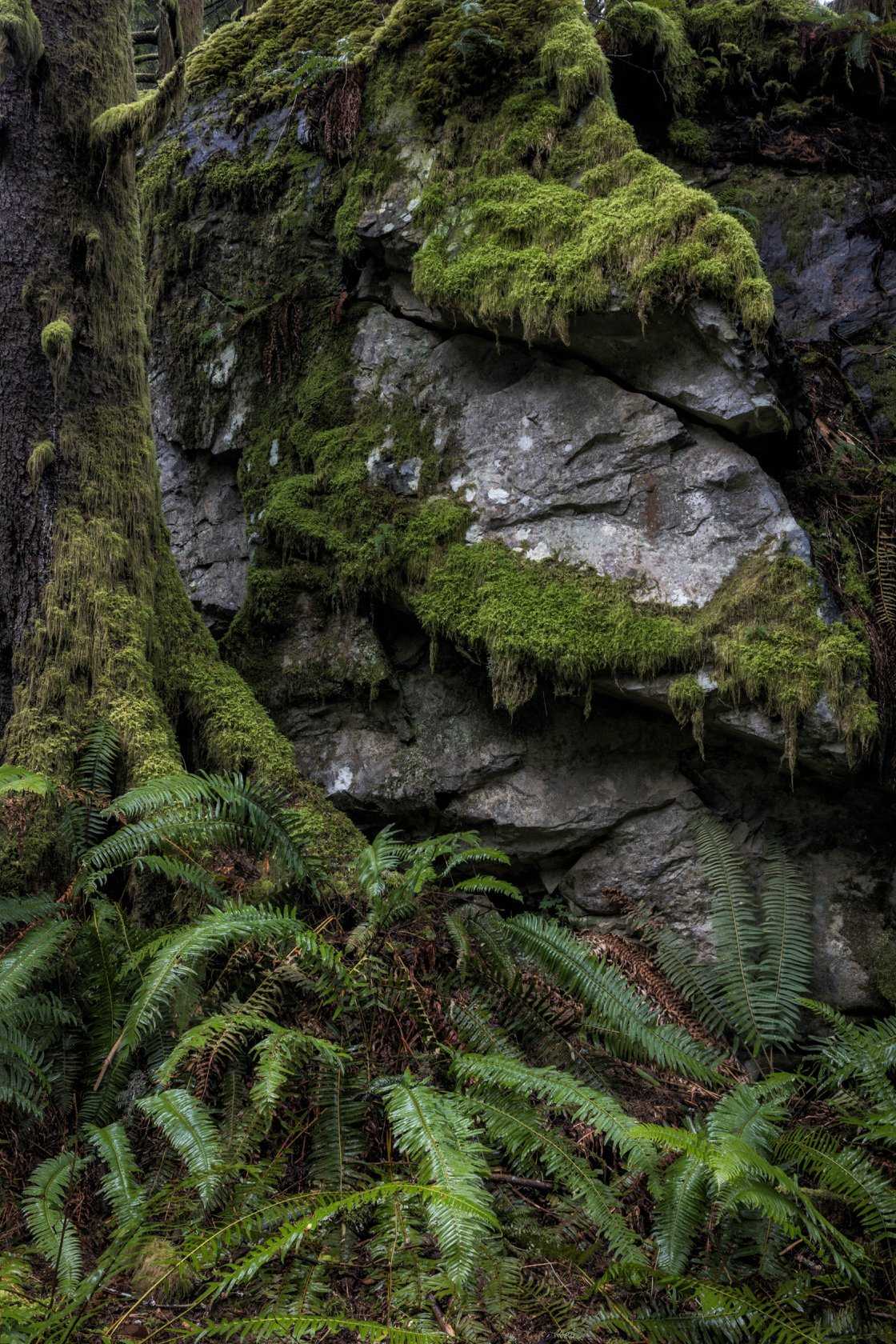
Olallie State Park, renowned for its magnificent waterfalls, is a terrific site to begin the trekking season. Moderate pathways go past the remnants of a major landslide to Cedar Butte, the less well-known Weeks Falls, the more well-known Twin Falls, and additional cascading water falls.
The 20-mile Olallie Trail, which rises more than 3,000 feet and offers breathtaking vistas of the Snoqualmie Valley, is perfect for mountain riders seeking a wilderness adventure. Rock climbers may spend days of fun on routes with difficult grades ranging from 5.5 to 5.13b in four separate cliff sites.
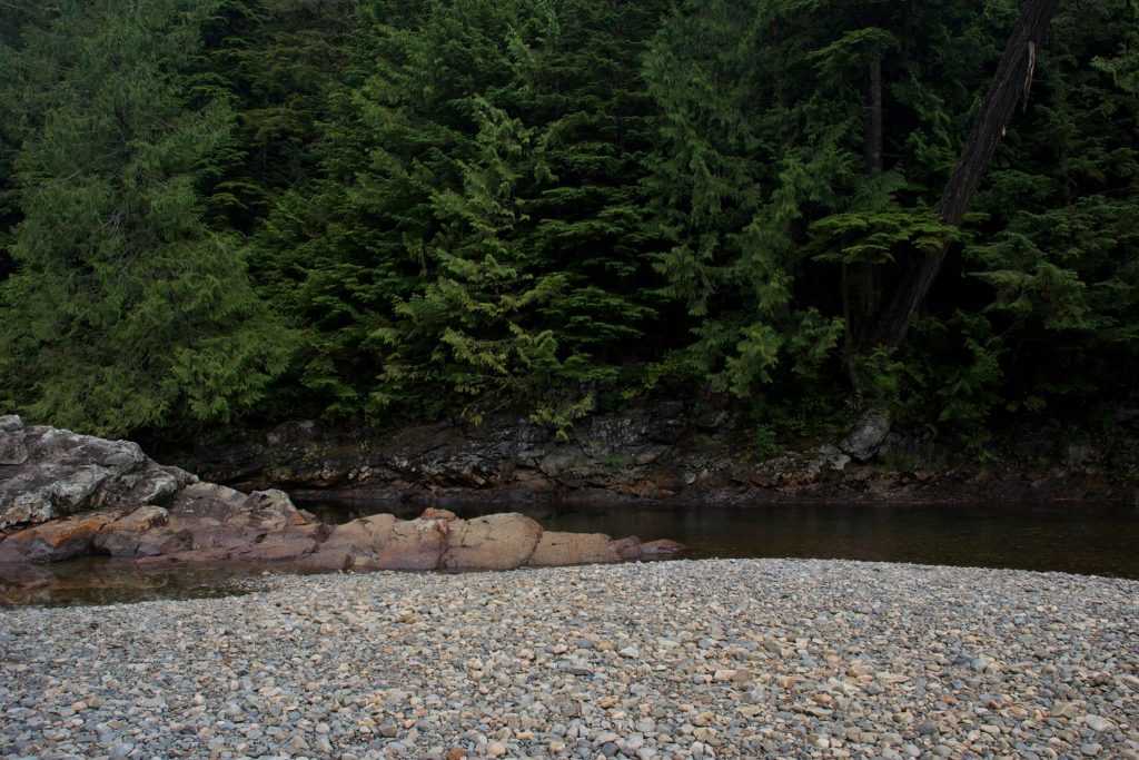
The Palouse to Cascades Track and a brand-new, exhilarating mountain biking trail may both be accessed from the Cedar Falls trailhead by long-distance hikers and riders. On the South Fork of the Snoqualmie River, fishing is rewarding.
This sizable day-use park is located on the western slopes of the Cascade Mountains, 45 minutes from Seattle. The park offers a classic Washington scenery with strong falls, thick forest, soaring cliffs, expansive views, and a rushing river, and includes a number of trailheads. Olallie is the place to go if you want to escape the city without making a long journey.

History
The park was established in 1950 when Puget Sound Power and Light sold a 160-acre property to Washington State Parks. After the park’s 1976 expansion, its name was changed from Twin Falls State Region to Olallie, a Chinook term for the berries that are plentiful in the park.
Features
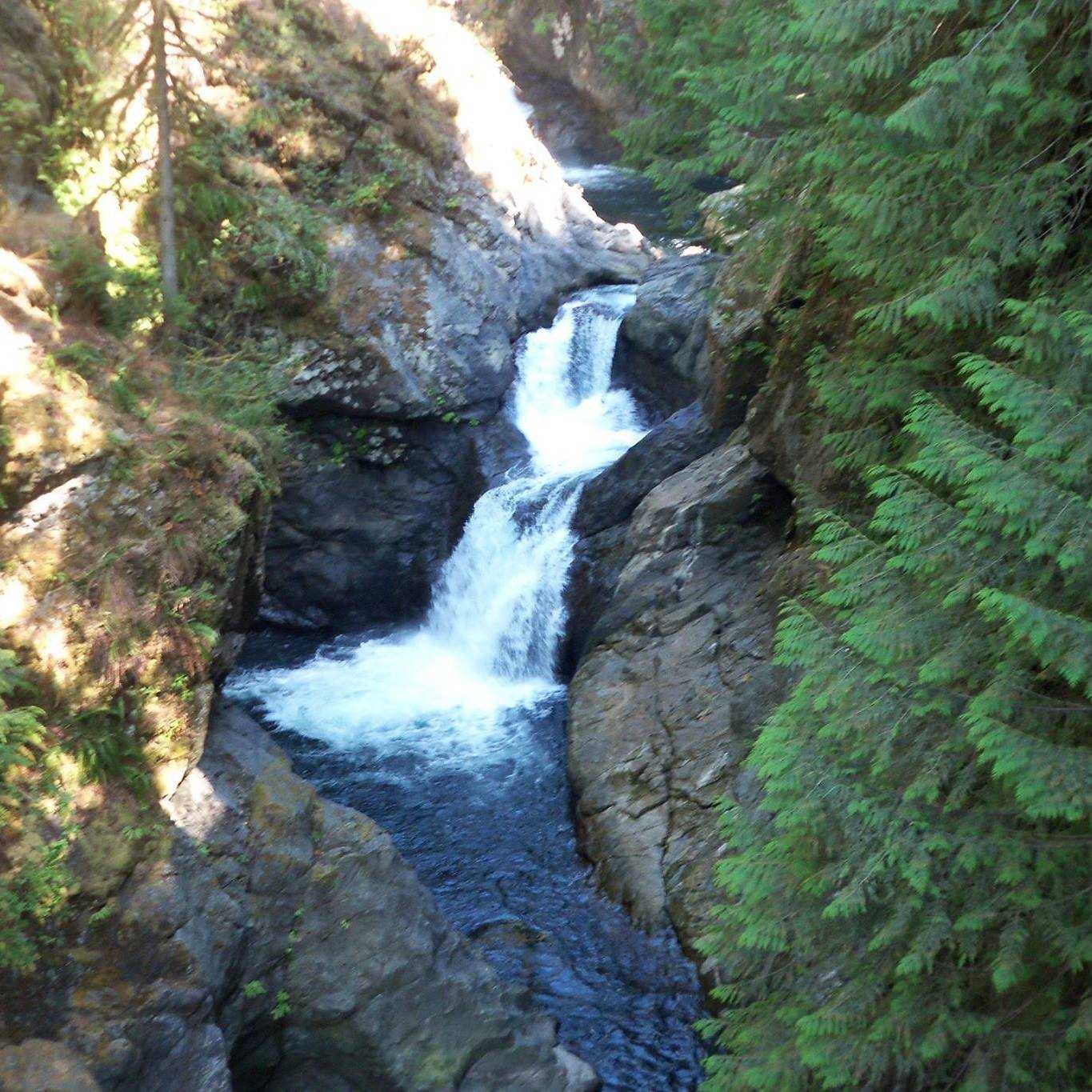
Five prominent waterfalls—Twin Falls, Middle Twin Falls, Upper Twin Falls, Weeks Falls, and Upper Weeks Falls—as well as old-growth woods can be found in the park.
24 MW of power are produced by an underground run-of-the-river hydroelectric facility in Twin Falls. The powerhouse is 325 feet (99 metres) underground.
Activities
ADA FACILITIES AND AMENITIES
- Restroom
- Hiking trail
DAY-USE & PICNIC FACILITIES
At the South Fork Picnic Area, the park provides a total of 11 picnic tables spread across two locations. All are offered on a first-come, first-served basis.
TRAILS
- 0.1 miles of ADA hiking trails
- 8.6 miles of mountain biking/mixed-use trails (The Olallie Trail)
- 6 miles of hiking trails
WATER FEATURES & ACTIVITIES
- Fishing (freshwater)
ADDITIONAL ACTIVITIES AND FEATURES
- Bird watching
- Mountain biking
- Rock climbing
- Wildlife viewing
TRANSLATIONAL OPPORTUNITIES
At the South Fork Picnic Area, a short grove of old-growth trees is traversed by an interpretive route. Visitors may learn more about the Snoqualmie Wagon Road—the original route from Ellensburg to Seattle in the 1800s—thanks to interpretive signs.
ADVANCED INFORMATION
Near the Palouse to Cascades State Park Trail, on the steep cliffs at Deception Crags, there is a well-known rock climbing spot (formerly known as the Iron Horse Trail). The climbing area may be reached from the Deception Crags Trailhead by a short, 1/4-mile route that follows Change Creek.
The Chicago, Milwaukee, St. Paul and Pacific Railroad (commonly known as the “Milwaukee Road”), which ended operations in 1980, converted into a rail-to-trail system known as the Palouse to Cascades State Park Trail, which has access from Olallie. Rattlesnake Lake in North Bend is where the Palouse to Cascades State Park Trail begins its journey to the Idaho border. On this path, hiking, biking, and horseback riding are all common activities.
Fishing is permitted in the river on occasion.
In Washington state parks, shellfishing and fishing are both prohibited without a recreational licence. Visit the Washington Department of Fish and Wildlife for rules, details on the fishing season, or to get a recreational licence.
Only kayaking is permitted below Twin Falls.
Park guide that is printable (PDF).

Trailheads
TRAILHEAD FOR CEDAR FALLS
The 1.5-mile Cedar Butte Trail in Olallie State Park may be accessed from the Cedar Falls Trailhead, which is also the westernmost point of Iron Horse State Park. It also offers access to the 108-mile John Wayne Pioneer Trail. This path is suitable for families and offers a leisurely ascent to Cedar Butte’s 1,870-foot top. The Boxley Blowout, a crater left in the hillside where a massive landslide and flood decimated the downstream village of Edgewick in 1918, may be seen from the walk.
FAR SIDE TRAILHEAD
The Middle Fork Natural Resource Conservation Area’s trails and crags are accessible to hikers and rock climbers through the Far Side Trailhead. The 4,680-foot top may be reached by hiking the 4.25-mile Dirty Harry’s Peak Trail. Views of the Upper Snoqualmie Valley to the west and the Alpine Lakes Wilderness Area to the east may be seen from Dirty Harry’s Peak. Six distinct climbing sites, ranging in complexity from 5.5 to 5.12c, are available to rock climbers.
HOMESTEAD VALLEY TRAILHEAD
A number of outdoor activities are accessible from the Homestead Valley Trailhead. The east end of the Twin Falls Trail may be reached by hikers using the John Wayne Pioneer Trail. The Deception Crags and Mount Washington climbing areas, which offer more than 100 routes ranging in complexity from 5.6 to 5.13b, are accessible to rock climbers. Mountain cyclists sometimes utilise the trailhead as their destination after travelling 12 miles downhill via the John Wayne Pioneer Trail from the Hyak Trailhead through the 2.3-mile Snoqualmie Pass Tunnel to Olallie.
SOUTH FORK FISHING ACCESS
The South Fork Fishing Access is a modest trailhead that gives fisherman access to the South Fork of the Snoqualmie River’s north bank. The three fish species most frequently encountered in the South Fork are whitefish, cutthroat trout, and rainbow trout.
SOUTH FORK PICNIC AREA
Two distinct picnic spots, one close to the Hall Creek Play Field and the other along the South Fork of the Snoqualmie River, are available at the South Fork Picnic Area, along with an interpretive walk. Picnic tables and grills are provided in both picnic areas on a first-come, first-served basis. The Snoqualmie Wagon Road Interpretive Trail begins close to the picnic area along the river and leads to Weeks Falls after passing through a small grove of old growth trees. The Snoqualmie Wagon Road, which was the initial route from Ellensburg to Seattle in the late 1800s, is commemorated by interpretive signage. Fishermen can access the river from the South Fork Picnic Area.
TWIN FALLS TRAILHEAD
The Twin Falls Trail traverses the rainforest on the western slopes of the Cascade Mountains as it follows the South Fork of the Snoqualmie River. The trail’s Twin Falls vistas are its most famous feature. A flight of steps leads to a viewing of the Lower Falls as they cascade over a 135-foot precipice a little more than a mile from the trailhead. For a glimpse of the Upper Falls, continue hiking another quarter-mile to a bridge that crosses the tight Twin Falls canyon. The John Wayne Pioneer Path is crossed by the trail after another mile. Fishermen and kayakers frequently access the river from the Twin Falls Trailhead.
