
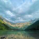
Introduction of Henry Coe State Park
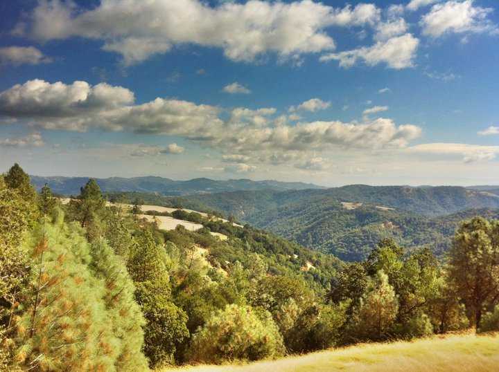
The largest state park in northern California, Henry W. Coe State Park, safeguards and maintains 87,000 acres of picturesque hills and mountain ridges in the Diablo Mountain Range. Backpackers, horseback riders, mountain bikers, day hikers, and anybody else looking for tranquilly in a mainly unspoiled setting are all welcome in this park.
Wildflowers bloom profusely in February through March after a wet winter; by April, the colour is out of control. Bright yellow gold fields, orange-yellow California poppies, baby blue eyes, and a variety of flowers dot the landscape. In late April and early May, mariposa lilies, larkspur, wild hyacinth, and Ithuriel’s spear bloom. Visitors come from far and wide because of the flora’s richness and diversity.
Highs exceeding 90 degrees Fahrenheit are common during the dry, hot summers, with overnight lows in the 50s. Even on easier treks, hikers should bring enough of water and consume lots of it. Henry W. Coe State Park has some really rough terrain. Long-distance (5+ miles) hikers should be prepared for backcountry travel, bringing enough of water and water purification equipment, among other things. Even so, it might be challenging to locate water in the heat.
Lows in the 30s and highs in the 50s characterise the damp winter season. Seasonal streams can flood in the winter, becoming inaccessible and potentially dangerous. The most comfortable and fun seasons to visit are spring and fall. Layered clothing is the best way to prepare for the unpredictable weather and rocky terrain.
Henry Coe State Park Activities
Hiking
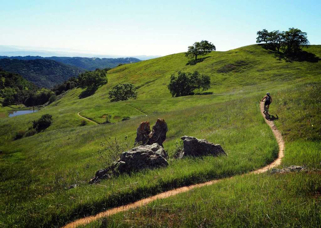
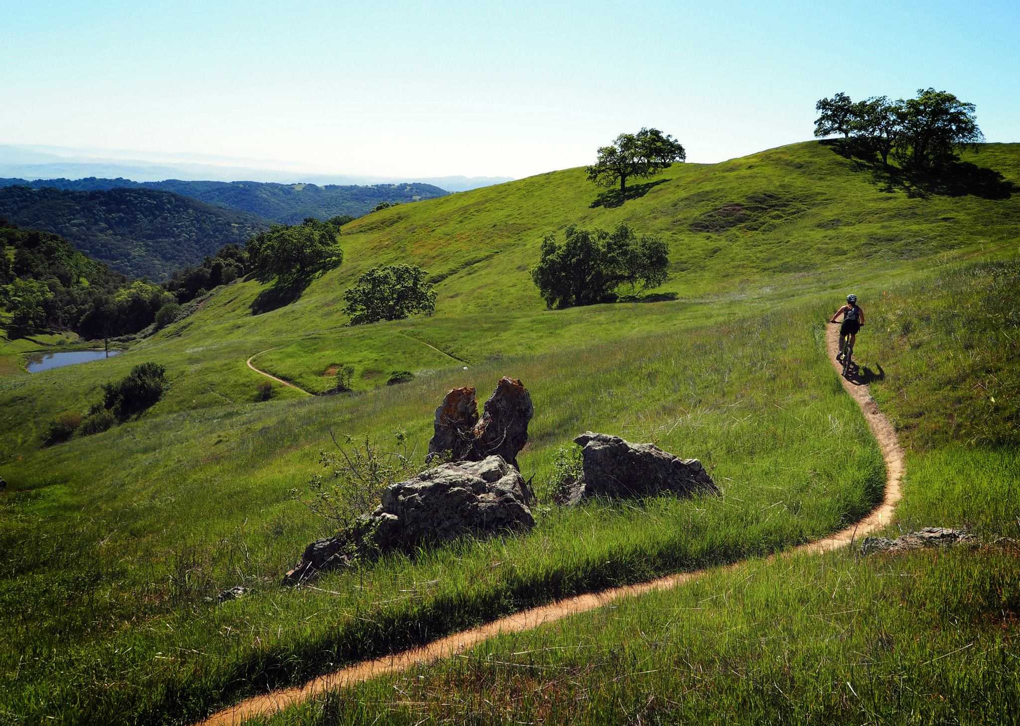
The majority of the park’s wide trail system is made up of old ranch roads that are accessible to hikers, bikers, and horseback riders. The more than 40 miles of trails that branch out from the park headquarters area allow day hikers to plan a route across the park’s original core.
One of the highest points in the park is the visitor centre, which is located at a height of around 2,600 feet. In other words, the majority of paths go downhill, making the ascent on the way back difficult.
Backpackers have excellent chances in the park. For multi-day excursions, the Orestimba Wilderness is a highly well-liked location. The distance between water sources might vary depending on the season. Find out which springs are flowing by asking at the tourist centre, and filter all water. On the reverse of admission charge receipts, it is stated that backcountry permits are necessary.
Camping
The visitor centre and Headquarters Campground are both close to the summit of Pine Ridge. Some locations provide expansive vistas, while others are sheltered by tall oaks. Each campsite features a fire ring and a picnic table. There are shade ramadas on sites that are not surrounded by trees. The campground, which is regarded as basic, includes adjacent pit toilets and piped spring water, but no showers or hookups. Only the fire rings at the campsite are permitted for use; the tourist centre sells firewood. Other supplies are not offered in the park; the closest town is 13 miles to the west, at Morgan Hill. Make arrangements for camping by calling 800-444-7275. Sites are frequently accessible on a first-come, first-served basis; if there is no personnel at the gate, register and pay at the “iron ranger.”
Historic Sites
A location of solace was Gilroy Hot Springs. The resort drew prominent businessmen from the San Francisco Bay region between the 1860s and the 1920s. It was established by H.K. Sakata in 1938 as a haven for Japanese and Japanese Americans to recover from the strain of hard labour and societal expectations. On the National Register of Historic Places is this State Historic Landmark. Arrange a tour by calling the park.
A bookshop, registration/information desk, and displays on ranching life are all located in the tourist centre.
Horseback Riding
The backcountry offers calm, pleasant rides and stunning scenery. Rugged and steep terrain is present on longer journeys or during horse camping. For further details about equestrian activities, contact the Henry W. Coe SP offices.
Bicycling
There are 250 miles of dirt roads and trails throughout the park, some of which are off-limits to mountain bikes because of their varying stages of development. Others are rutted and narrow, while some are broad and rather smooth. The majority of the trails are well-kept and clearly marked, especially those close to the headquarters. For trail conditions, contact the Henry W. Coe SP headquarters.
Fishing
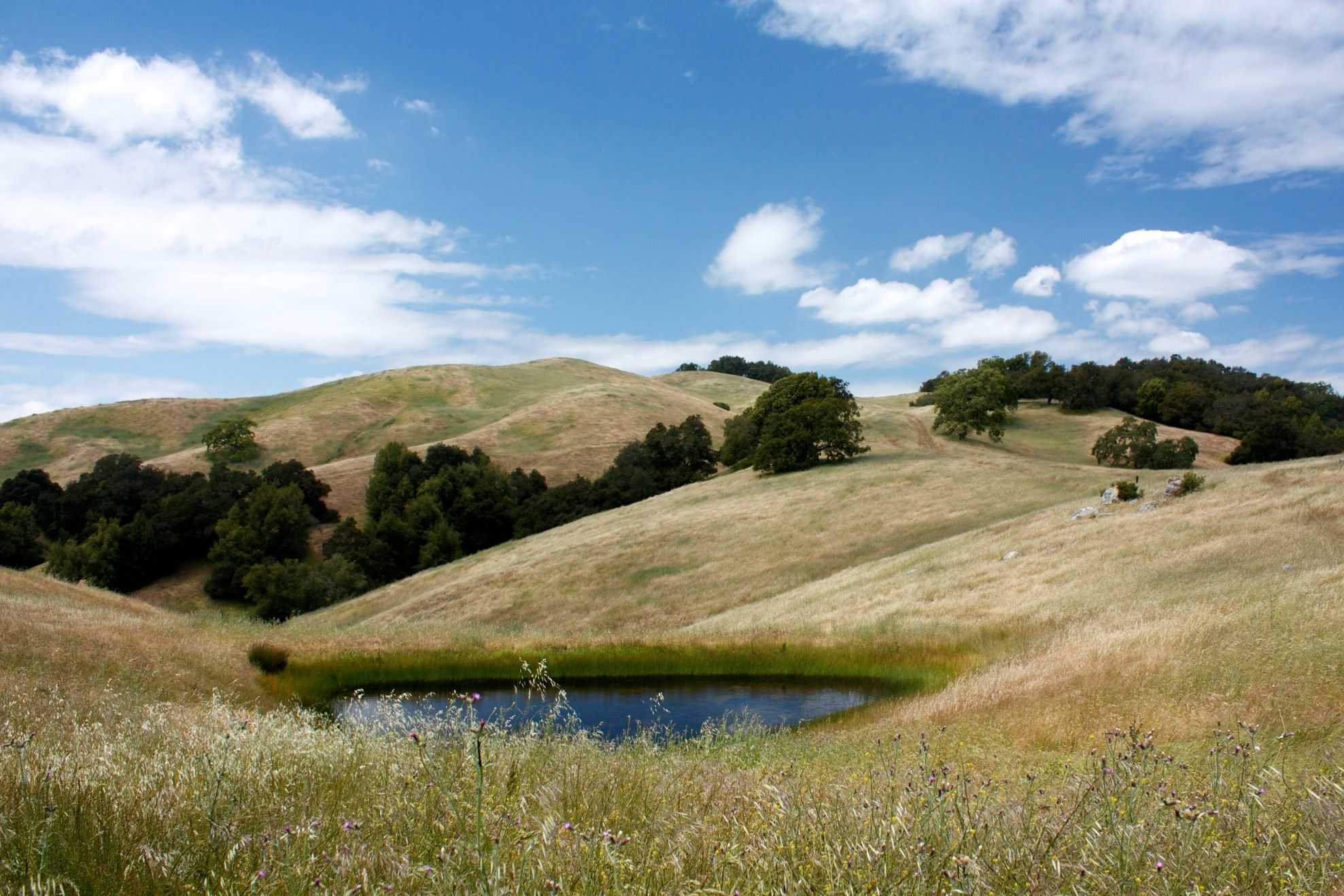
Although none of the park’s lakes, streams, or ponds are accessible by automobile, fishing for largemouth bass, bluegill, crappie, and green sunfish is superb. Hikes can be up to 10 kilometres roundtrip.
Picnicking
Picnics are permitted all across the park.
Henry Coe State Park History
La Vereda del Monte, a path between Point of Timber on the Sacramento River Delta and Cantua Creek in the San Joaquin Valley, once passed through the Diablo Range wilderness currently occupied by Henry W. Coe State Park. Joaquin Murrieta and his gang used the route to transport wild or stolen horses from Contra Costa County south, picking up more from stables along the way. From the San Antonio Valley, they entered the area of the park via a trail that closely resembled County Line Road’s path along the Diablo Range’s divide. Horses were kept in a number of areas that are now a part of the park, including Paradise Flat, Mustang Flat, Valle Atravesado, which is now submerged by Mississippi Lake, Valle Hondo, the location of Pacheco Camp. The deeds of Murrieta and his band are the source of the names of both Mustang Peak and Mustang Flat. The horses housed at Paradise Flat or Mustang Flat were fed into a passing drove at Mustang Peak.
Pine Ridge Ranch, a 12,230-acre private cattle ranch, was the park’s original name (4,950 ha). From 1905 until his passing in 1943, Henry Willard Coe, Jr. and his family called it home. Henry Sutcliffe Coe, who received the ranch from Coe after his death, sold it to the Beach Land and Cattle Company of Fresno County in 1948. During this time, the ranch’s road system was considerably enlarged. The ranch was once again bought by Coe’s daughter, Sada Sutcliffe Coe Robinson, in 1950, and was transferred to Santa Clara County in 1953, when it became Henry Willard Coe County Park. In 1958, it was made a state park. As more nearby areas were added, the park’s size increased to 13,000 acres for a while (5,300 ha). In fact, the park is still depicted on many of the state’s current road maps with its original 13,000-acre layout. With the acquisition of neighbouring holdings to the east and south (the Gill-Mustang and Coit ranches, respectively), the park significantly increased in size in the early 1980s, reaching a total of 67,000 acres (27,000 ha). Around 11,000 acres (4,500 hectares) were added to the Redfern Ranch in the early 1990s, and since 2000, holdings to the west have been bought for inclusion. Park expansion continues.
Beginning on September 3, 2007, a sizable wildfire ravaged the park’s northern region, encompassing the Orestimba Wilderness. The fire, which was known as the Lick Fire after the Lick Observatory in the area that first discovered it, spread to 27,000 acres (11,000 hectares) by September 6’s nightfall and eventually consumed 47,760 acres (19,330 ha) by the time it was put out on September 11. The blaze was attributed by fire officials to garbage burning inside a barrel at a hunting club next to the park. The arsonist came forward, entered a plea of not guilty to a misdemeanour charge, and was eventually required to make a $750,000 reparation payment. On February 16, 2008, all impacted places were reopened to the general public without any restrictions.
Transportation
Driving
The primary entrance of Henry W. Coe State Park is located on East Dunne Avenue, 13 miles east of Morgan Hill. Take the East Dunne Avenue exit from Highway 101 in Morgan Hill (a half-hour south of San Jose), then proceed east through Anderson Lake to the end of the county road to the park administration. Beyond Anderson Lake, a 10-mile-long, winding, narrow road leads to the park. It will take roughly 30 minutes to get there. The coordinates are 37.2110 and -121.5141.
The Bell Station Restaurant Road, which is on the north side of Highway 152, is where you’ll find the Dowdy Ranch/Bell Station entry, which is five miles east of the 152/156 Interchange. To get of the entrance to Dowdy Ranch Park, turn left and go seven miles along an unpaved road.
Flying
Henry W. Coe SP is just around 22 miles from San Jose International Airport, the closest big airport. Car rental services are accessible from there. Call 408-392-3600 for further details.
Parking
Parking is available.
Public Transport
Public Transport is available.
