
Introduction of Camels Hump State Park
Tah-wak-be-dee-ee-wadso, or Saddle Mountain, was the Waubanaukee Indians’ original name for it. The 1600s explorers headed by Samuel de Champlain referred to it as a “lion couchant,” or sleeping lion. Ira Allen first used the term “Camel’s Rump” on a historical map in 1798; it was later renamed “Camel’s Hump” in 1830.
Colonel Joseph Battell, who first purchased Camel’s Hump to preserve the wooded mountain vista from his residence, originally donated 1000 acres of the park, including the top. The mountain was given to the Form Forester’s care in 1911, and he administered it with the intention of maintaining it in a primitive state as per Battell’s request.
In order to maintain aesthetic qualities, the State of Vermont finally enacted a policy of development control on all state forest holdings. The Natural Area of the summit was defended against proposed invasions by communications towers and ski resorts until special legislation was approved in 1969 to establish a Forest Reserve, whose state-owned acres (about 20,000 by 1991) formed Camel’s Hump State Park.
Camping at Camels Hump State Park
Camels Hump State Park Activities
Hiking
From the Duxbury side: Although the Monroe Trail presents some challenges, there is also an accessible loop that has a separate parking spot. This circle is ideal for older people and little children since it is 8/10 of a mile long, broad, and level, and it includes three viewing areas to the peak of Camel’s Hump.
From the Huntington side: The Burrows Trail is a bit shorter and attracts lots of hikers. Always a good idea to get there early (8AM) on a good weather weekend day to get parked and on the trail.
Hiking with groups: If you are hiking with 10 or more people or charging fees, or publicizing the event, you will need to apply for a Special Use Permit.
Hiking during spring season: When the snow starts to melt, the trails close, and they reopen the weekend before Memorial Day. Even so, it’s advisable to avoid muddy, really wet paths; just use your best judgement. Until then, there are alternate routes like Bolton’s Honey Hollow Road, the Camel’s Hump area’s forest roads, or the CCC road at Underhill State Park.
Discover Camels Hump State Park
Getting Outdoors
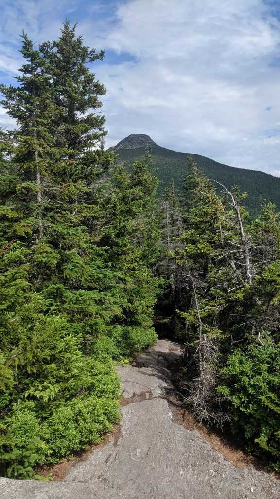
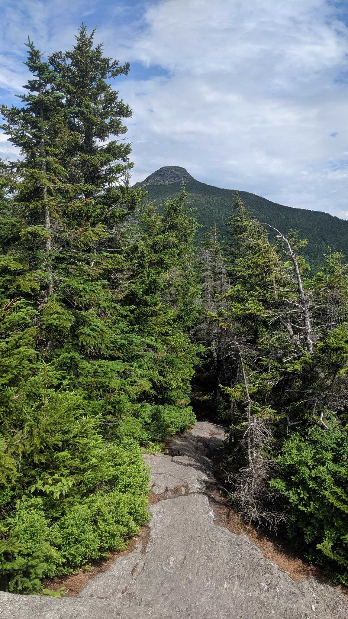
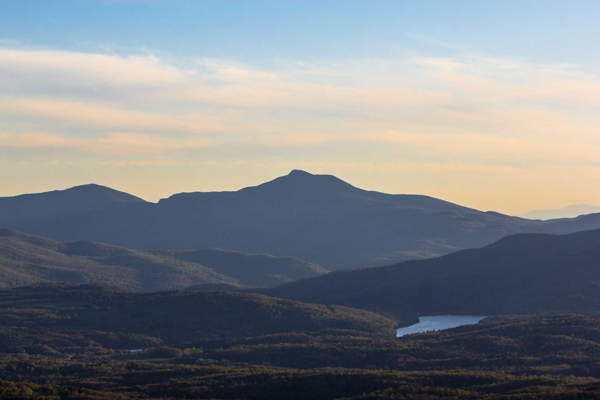
Green Mountain range includes Camels Hump State Park. Camel’s Hump, the mountain in question, is Vermont’s third-highest peak but the only uninhabited one. The peak’s Alpine tundra vegetation is treasured since it is one of the few mountains in New England with this kind of ecology. The Long Path, which stretches 273 miles, is the oldest trail in the country. The path begins close to Jay, Vermont, which is close to the US-Canada border, and winds its way south before coming to an end south of Stamford, Vermont. Along the way, it passes through Camels Hump State Park. The Long Trail branches out onto offshoot paths that total another 100 kilometres in length. According to legend, this trail served as the model for the development of the more than 2,000-mile Appalachian Trail, which runs from Maine to Georgia.
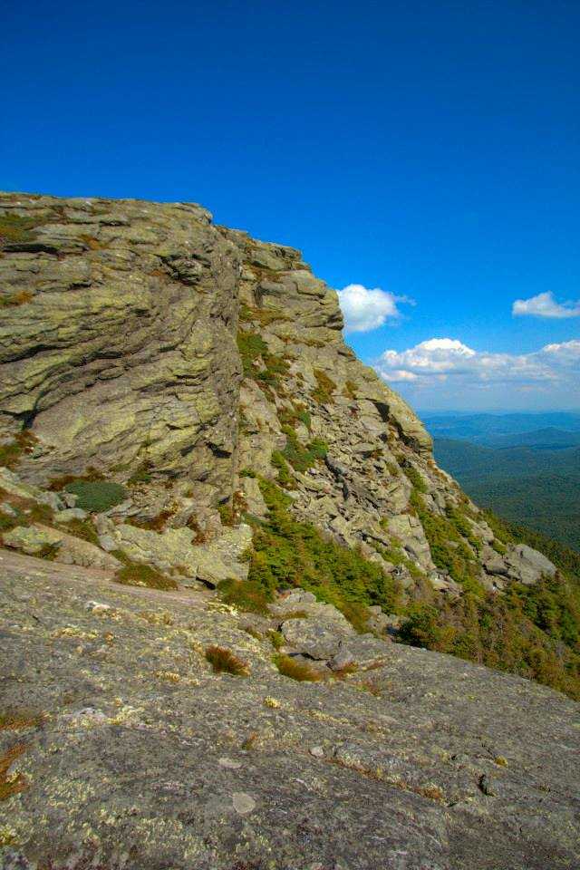
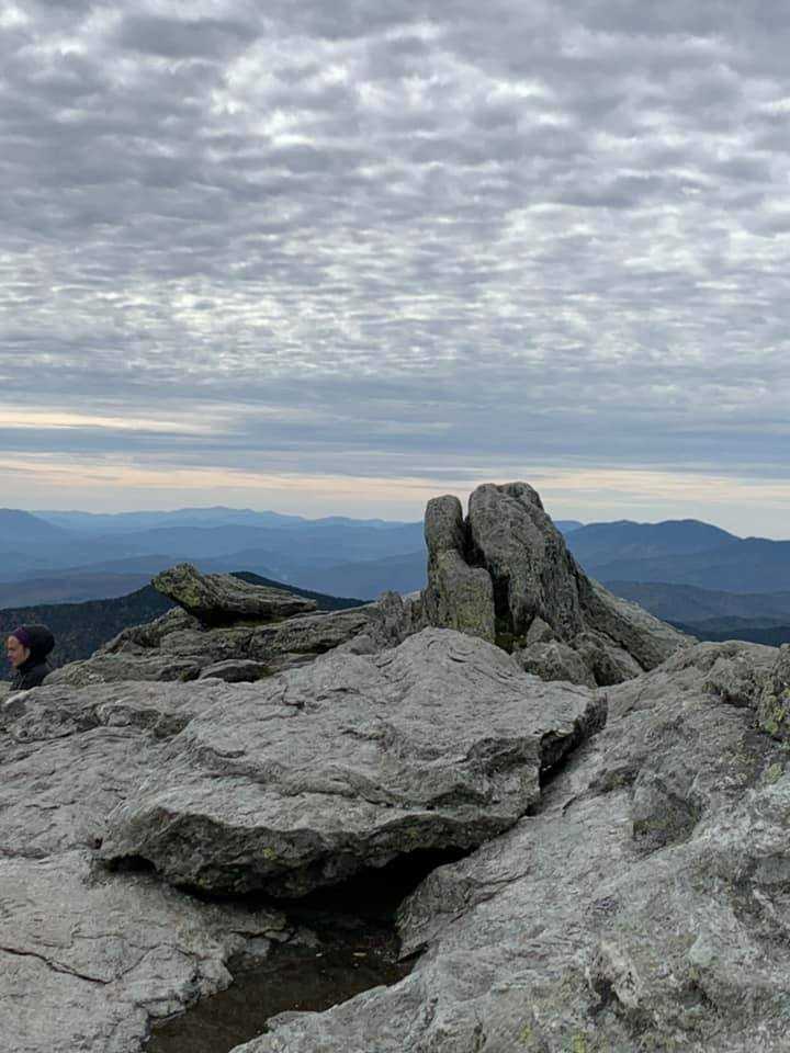
Although there are several routes in Camels Hump State Park that wind through the forest, the trails that lead to the mountain’s peak are what most explorers and hikers come for. One way is simple, while the other, which climbs the peak’s face, is noticeably harder. There is no incorrect choice for hikers. Hikers are rewarded with a magnificent view of the surrounding Vermont mountain ranges after reaching the summit. The summits in New York and New Hampshire are visible on particularly clear days.
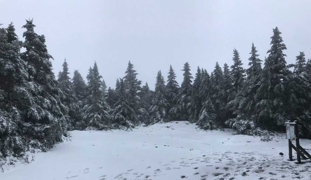
Northern Vermont experiences lengthy and occasionally extremely cold winters. But if one allows the weather keep them inside, they’ll stay there for weeks or even months. Smart explorers pack up and hit the trails. Popular winter sports include sledding, snowshoeing, and cross-country skiing. Ice fishing, outdoor hockey, and ice skating are all popular activities on nearby lakes.
Exploring the Area
Without taking on the road to see the oddball tiny villages dotted around the state, no trip to Vermont is complete. During the yearly fall leaf-peeping quest to locate the ideal tree-lined scene with brilliant red and gold leaves, a large number of people come to Vermont. Step into a rented RV and travel a beautiful backroad. Look at the many still-standing covered bridges. There are two covered bridges in the nearby town of Waitsfield.
When there, turn west and travel to Burlington, Vermont. The progressive college town is renowned for its thriving nightlife and cutting-edge art galleries. Many charming stores, independent artists, and other vendors offer their wares in the renowned Church Street Marketplace, an outdoor shopping centre. It’s also a popular location for concerts and performers.
A fantastic Vermont RV camping vacation may be had by renting an RV close to Camels Hump State Park. Spend quality time with family and friends while discovering your joy in the Vermont highlands.
Camels Hump State Park History
Publisher, conservationist, and philanthropist Joseph Battell of Middlebury gave 1,147 acres (464 ha) of the forestland around Camel’s Hump to the State of Vermont in 1911. “Trees growing on the property thus granted are not to be cut…and the entire forest is to be kept in a primaeval state,” the deed stated. A section of the Battell holdings were included inside the 1,086-acre (439 ha) Camel’s Hump Natural Area, which the state established in 1965, 50 years after it was established.
In 1969, the State of Vermont defined an ecological region that encompassed all state holdings in the Camel’s Hump Forest Reserve above 2,500 feet (760 metres), as well as all land in the Gleason Brook watershed above 900 feet, as a byproduct of building Camel’s Hump State Park (270 m). The ecological area increased Camel’s Hump Natural Area to 5,708 acres and was created “to safeguard scarce and endangered flora, to preserve the natural ecosystem, and to maintain the wilderness element” of the property (2,310 ha).
The Phen Basin lot near Fayston, which is 2,700 acres (1,100 ha), was purchased by the State of Vermont in 1995. In order to promote the conservation of species, ecosystems, forestry values, public recreational possibilities, and scenic resources, around 80% of the parcel was classified as an ecological protection zone. The Ecological Protection Zone allowed Camel’s Hump Natural Area to expand to its present 7,850-acre size (3,180 ha)
Seasonality/Weather
Directions
Driving
Bamforth Parking Area for the Long Trail (this trail head may be accessed from either the east or the west, necessitating two descriptions):
The best way to get to this trailhead from the Burlington area or I-89 exit 11 is to take VT Route 2 through Richmond to Jonesville, turn right across the Winooski River bridge, then proceed on Cochran Road for a very short distance before taking the first left onto Duxbury Road. After travelling on Duxbury Road for about 3.1 miles, you will see the Long Trail parking area on the right.
The simplest way to get to this trailhead from the Waterbury region via I-89 exit 10 is to turn onto Winooski Street, go to its end, and then turn right onto River Road. Just over 0.1 miles on VT Rt. 2 from the intersection with Stowe Street at the traffic signal, or less than 0.2 miles from the Waterbury I-89 off-ramp when travelling left, will bring you to Winooski Street. After turning onto River Road, go approximately 6.5 miles to the Long Trail parking area, which is on the left.
The Long Trail, which crosses VT Rt. 17 near the top of Appalachian Gap, is the main entry point for the trail from the south. The VT Rt. 17 parking lot is open all year round. The distance from the intersection of Vermont Route 17 and Vermont Route 116 in Bristol is approximately 9.6 miles, and the distance from the intersection of Vermont Route 17 and Vermont Route 100 in the Waitsfield region is around 6.1 miles.
From the East: In the summer, parking lots for the Monroe Trail serve as the main entry point; in the winter, a close alternate parking facility is available. Camel’s Hump Road in North Duxbury is used as the approach to the Monroe parking lots, one of the busiest entrance sites to Camel’s Hump State Park.
The best route from the Burlington area, or I-89 exit 11, is to take Vermont Route 2 through Richmond to Jonesville, turn right across the Winooski River bridge, then proceed a very short distance on Cochran Road from the bridge to the first left onto the Duxbury Road, which becomes River Road at the Bolton/Duxbury towns boundary.
Turn right up Camel’s Hump Road after 5.8 miles to reach the stop sign at the beginning of the parking spaces on the opposite side of Camel’s Hump Road (there are two parking areas near each other here).
Turn left at the bottom of the Interstate ramp in Waterbury and go just under 0.2 miles to a right turn onto Winooski Street. Continue on this road until it ends at a junction with River Road. Turn right here and continue for about 3.8 miles until you reach a left turn onto Camel’s Hump Road.
To reach the parking area at the end of Camel’s Hump Road, continue up the road for about 3.6 kilometres. The alternate parking spot during the winter is located 3.2 miles up Camel’s Hump Road from River Road; turn left and proceed 0.1 miles to the parking lot.
The Burrows Trail is Camel’s Hump State Park’s busiest entrance point, while Forest City Trail is the main entry point from the west. The easiest route from the west is to take VT Rt. 116 from Bristol to its intersection with VT Rt. 17, then turn right onto VT Rt. 17 and travel for about 7 miles before turning left onto Gore Road, which then becomes Main Road.
Turn right onto Camel’s Hump Route in Huntington Center after travelling approximately 6.2 miles on this road. From there, go approximately 3.4 miles to the Burrows Trail parking area at the end of the road.
From the I-89 exit 11, take VT Route 2 to Richmond, then turn right onto Bridge Street at the traffic light. Continue on this road for just over 9.4 miles until it becomes Huntington Road, then Main Road. From here, turn left onto Camel’s Hump Road, and follow it for about 3.4 miles until it ends at the Burrows Trail parking lot. About 2.6 miles up Camel’s Hump Road from the Main Road lies the Forest City trailhead.
Parking
At trailheads along Camel’s Hump Road, there are designated parking spaces on both sides of the mountain. In Duxbury, there are also parking spaces along River Road for the Long Trail.
Please abide by the rules of the road. On the roads that lead to our trailheads, there are families with young children. Visitors should respect these cultures by travelling cautiously and gently.
