Boating
Preparing for Your Trip
Weather\sSafety
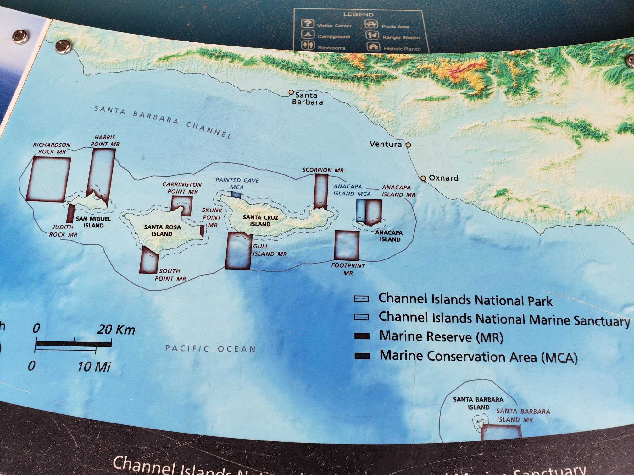
Permits and Procedures for Landings
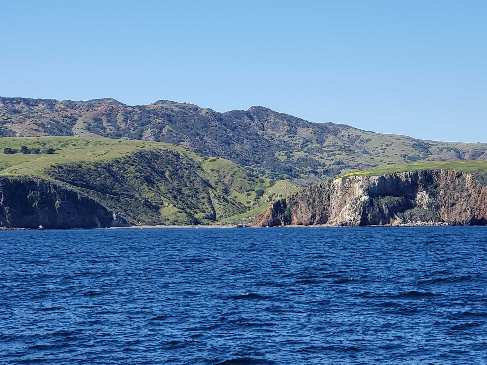
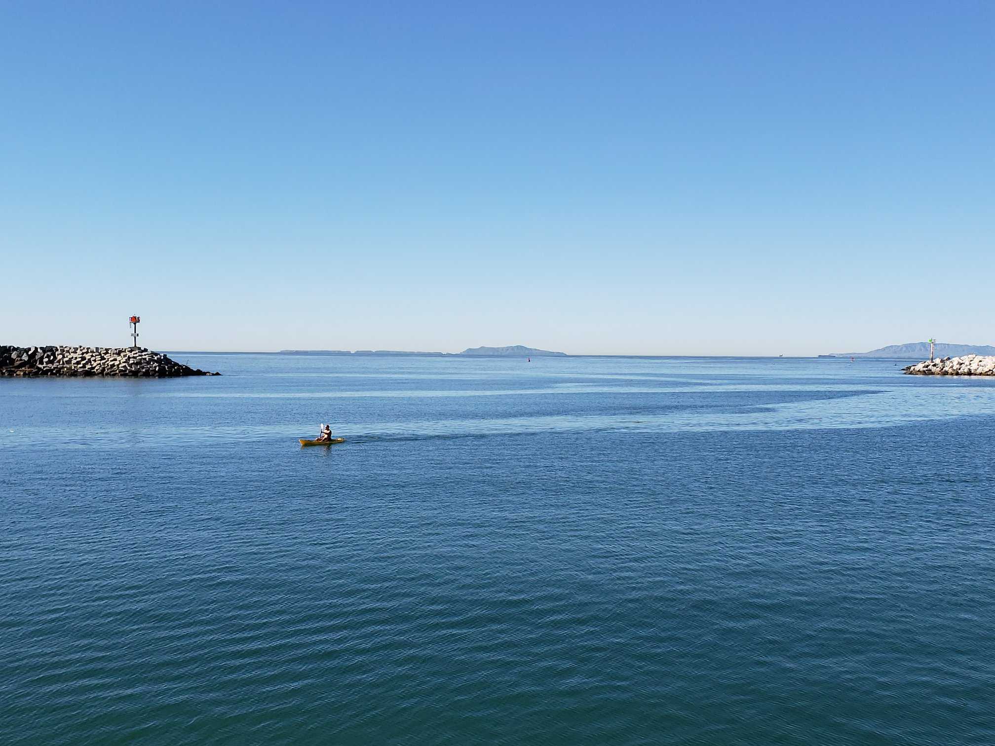
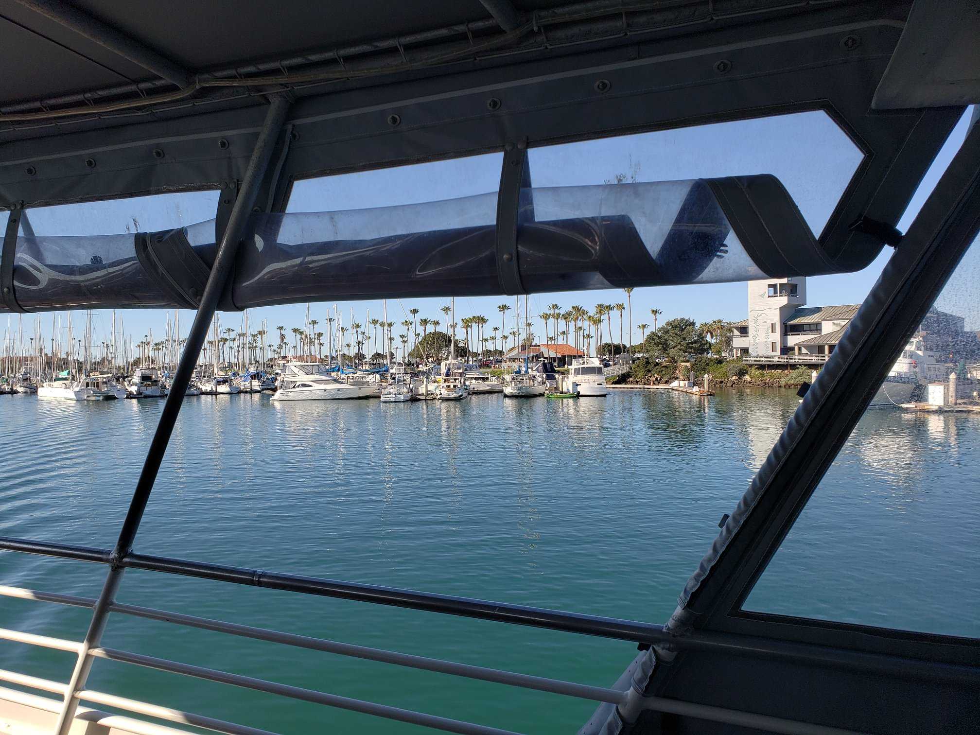
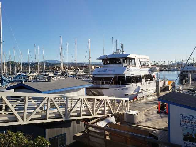
In the Channel Islands National Park, boating (with the exception of personal watercraft; see the Laws and Policies for more information) is a unique and rewarding way to appreciate and experience the pristine marine environment. You will find solitude and splendour in this location. You will also face new challenges and may come across unexpected dangers in this location. This section is intended to assist you in planning a boating trip that is safe, enjoyable, and environmentally friendly while visiting the park. Private boaters are welcome to dock on any of the park’s five islands at any time of the year.
Preparing for Your Trip
For assistance in deciding which island to visit, specific island information is available at Places To Go or from the visitor centre in the form of publications, exhibits, and the park movie, among other resources.
Comprehensive boating information about the channel and islands is available from the United States Coast Guard (USCG) “Local Notice to Mariners” publication, which can be obtained by contacting the Coast Guard at (510) 437-2981. Local marine stores as well as online bookstores carry cruising guides to the Channel Islands, as well as nautical charts. For more information, consult National Ocean Survey charts 18720, 18721, 18725, 18727, 18728, 18729, and 18756 from the National Oceanic and Atmospheric Administration (NOAA).
Visitors may go boating on their own or with a commercial service operator who has been authorised by the park. It is not recommended that novices or anyone who is not properly trained, conditioned, and equipped attempt boating due to the hazardous weather conditions that exist. Currents, shifting swells, fog, and strong winds can all change the course of a boat’s journey through the channel. The journey to the islands takes boaters through some of the busiest shipping lanes in California on the way to the islands. Ships travelling at speeds ranging from 25 to 35 knots present a unique hazard to boaters as they cross the channel.
Around the islands, there are no public moorings or all-weather anchorages. We recommend that at least one person remains on board the boat at all times. Boaters are liable for any damage to the environment that their vessel may cause to the environment.
The weather in the Santa Barbara Channel and the surrounding islands is unpredictable, and the ocean is unforgiving in its harshness. Making the cross-channel passage is only recommended for experienced boaters with vessels that are capable of withstanding severe weather conditions. Obtaining the most up-to-date weather broadcast from the NOAA Weather Service can be done by calling (805) 988-6610, visiting the Channel Islands National Marine Sanctuary’s Internet Weather Kiosk, or by listening to weather radio on VHF-FM 162.475 MHz (weather station 3) for marine forecasts and VHF-FM 162.55 MHz (weather station 1) and VHF-FM 162.40 MHz (weather station 2) for land-based observations on VHF-FM 162.475
The weather conditions in the channel are extremely variable. August through October are frequently the months with the calmest winds and sea conditions. The other months are subject to a significantly higher risk of adverse wind and sea conditions, as well as sudden and unexpected changes. High winds may occur regardless of whether or not a forecast is issued. Winds of up to forty knots are not uncommon on the Santa Rosa and San Miguel Islands. The islands of Anacapa and Santa Barbara are characterised by more moderate winds.
Winds are usually calm in the early morning hours and increase in strength during the afternoon hours. Generally speaking, the wind is from the northwest, but boaters should be prepared for strong east or Santa Ana winds at any time of year, but especially from September through April.
Dense fog is most common during the summer months, but it can occur at any time, necessitating the use of a chart and compass for navigation. It is possible to encounter ocean currents of considerable strength both near and offshore from the islands. The temperature of the ocean water varies from the lower 50s (°F) in the winter to the upper 60s (°F) in the fall, depending on the season.
Safety
It is not recommended that novices or anyone who is not properly trained, conditioned, and equipped attempt boating due to the hazardous weather conditions that exist. Currents, shifting swells, fog, and strong winds can all change the course of a boat’s journey through the channel. Around the islands, there are no public moorings or all-weather anchorages. We recommend that at least one person remains on board the boat at all times.
Prior to leaving the harbour, boaters should always file a formal float plan with the harbormaster in order to avoid delays. Your family and/or friends should also be made aware of your floatation strategy. There should be a list with the names and addresses of the boaters as well as emergency phone numbers. Boating trip plans should also include the number of boats and boaters who will be taking part in the trip, as well as the colour, size, and type of vessel that will be used. There should be a list of any survival and special emergency equipment available (EPIRB, VHF, food rations, flares, etc.). The location, date, and time of departure and return, as well as the final destination, should be recorded (s). Having this information can be extremely useful if something goes wrong during a search operation. Keep in mind that your plans may need to be modified. The weather should always be the determining factor in your decision-making.
Shipping Routes: There are several major shipping routes that run between the islands and the mainland. The location of these structures should be noted by boaters, who should exercise caution when passing through them. All boaters should pay attention to the United States Coast Guard’s notice to mariners broadcast on VHF channel 22 because the waters in and around the park are occasionally closed to allow for military operations.
Caves in the sea: Caves in the sea can be extremely dangerous because large waves or swells can suddenly fill a cave with water. Extending your exploration of sea caves requires extreme caution and the wearing of a helmet. Information on sea cave closures can be found in the Laws and Policies section.
Permits and Procedures for Landings
It is not necessary to obtain a landing permit to visit the islands administered by the National Park Service (NPS). The Nature Conservancy (TNC) owns land on Santa Cruz Island, and landing on their property is subject to a landing permit requirement.
On each island, there are areas that are off-limits or restricted. Please keep in mind that landing on or near any of the islands is prohibited year-round due to the presence of rocks or islets, and that pets are not permitted in the park. If you require additional information on regulations and guidelines, please refer to Laws and Policies and Minimizing Your Impact.
In order to receive an orientation, daily events information, island safety instructions, weather forecasts, or to check-in for a camping site on each island, it is recommended that boaters contact the park ranger on each island before landing. VHF Channel 16 is occasionally monitored by park rangers. Channel 16 is only used for hailing purposes, and rangers will instruct you to switch to a different channel if they come into contact with you. If you are unable to contact the park ranger on the island where you intend to land, try contacting one of the other island rangers on a neighbouring island. This is because island canyons and mountains can sometimes interfere with radio communications.
It is possible for boaters to land using the following procedures:
Santa Barbara Island: There is no need for a permit to land or hike on the island of Santa Barbara. The landing cove is the only point of entry to the island and is strictly enforced. The landing dock is only available for the purpose of unloading cargo. No craft, including kayaks and inflatables, should be left moored to the dock for extended periods of time. Please raise your inflatables to the upper landing and secure them there.
On East Anacapa Island and at Frenchys Cove, there is no need to obtain a permit in order to hike or camp. West Anacapa (with the exception of Frenchys Cove) is a protected research natural area that is not open to the general public. Visitors are only permitted on Middle Anacapa with a permit and must be accompanied by a park ranger at all times.
The moorings near the landing cove on East Anacapa Island are reserved for the exclusive use of the National Park Service, the United States Coast Guard, and the park concessionaire. Unless otherwise specified, private boats must anchor at least a reasonable distance from these moorings. This is not an all-weather mooring point, as the name implies. We recommend that at least one person remains on board the boat at all times. The landing dock is only available for the purpose of unloading cargo. No craft, including kayaks and inflatables, should be left moored to the dock for extended periods of time. Your inflatables and kayaks should be lifted up to the lower landing area.
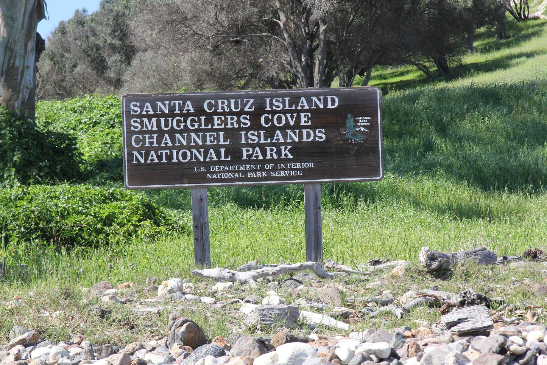
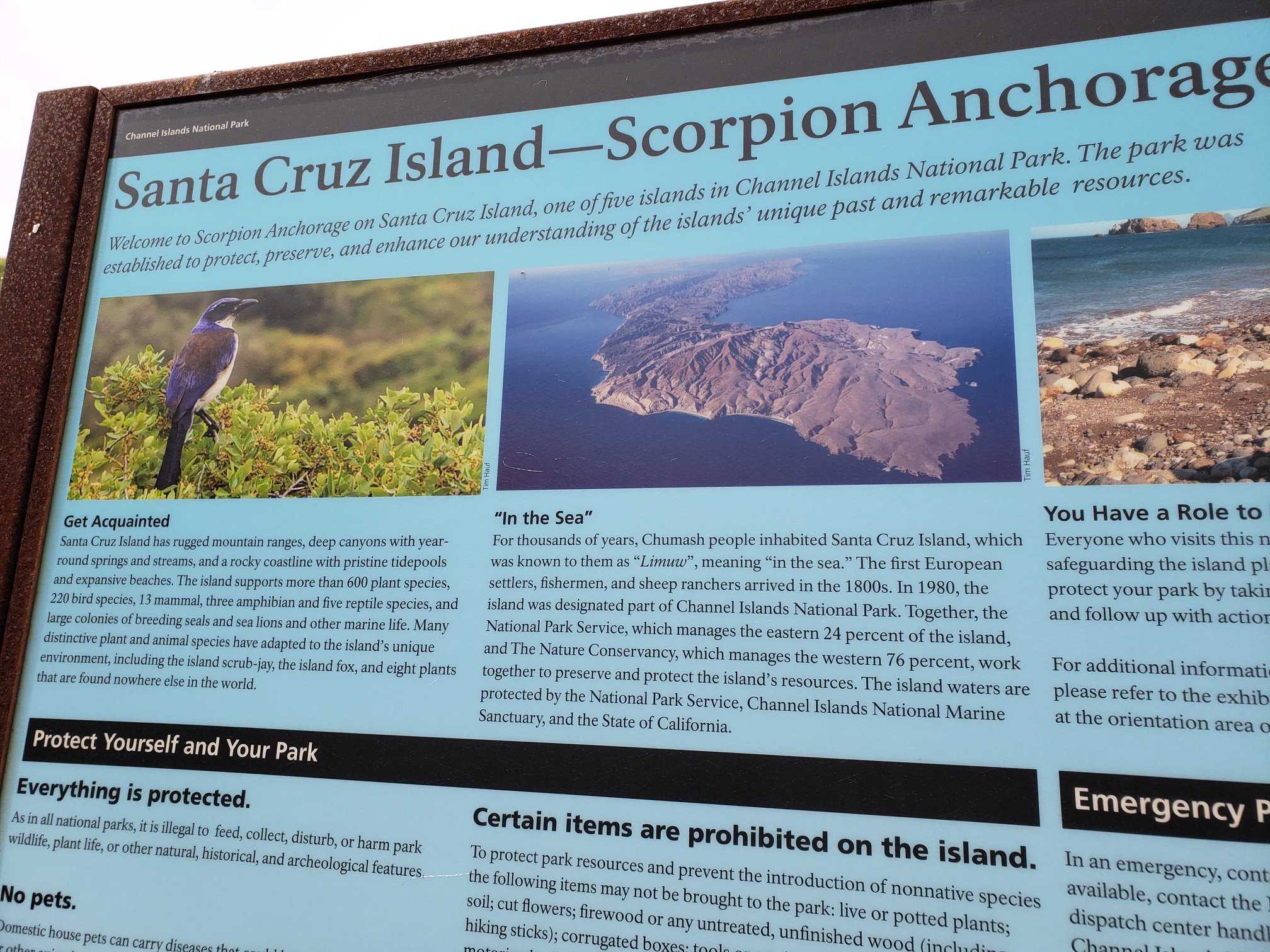
Boaters can land on the eastern 24 percent of Santa Cruz Island without a permit if they are sailing from the mainland. These lands are owned by the National Park Service (NPS) and are located east of the property line between Prisoners Harbor and Valley Anchorage. Landing is prohibited along the shoreline between Arch Point (northwest of Scorpion Anchorage) and the eastern boundary of Potato Harbor in order to protect seabird nesting areas. There are no buoys available at any of the landing areas. Buoys are reserved for the National Park Service and the United States Coast Guard. Scorpion Anchorage and Prisoners Harbor both have piers that can be used. Smugglers Cove, as well as the beaches facing south and southeast between San Pedro Point and Sandstone Point, should be approached with extreme caution due to the current conditions of swell, surf, and tides.
To land on the remaining 76 percent of Santa Cruz Island, you must first obtain permission from TNC. There is a fee to use the island, and it is not permitted to stay overnight. For more information and to obtain a permit, go to www.nature.org/cruzpermit. Allow at least 10 business days for the processing of your application.
Boaters can land along the coastline and on beaches on Santa Rosa Island without a permit for daytime use only, according to the National Park Service. During the months of March and September, the back beaches and sand dunes between Skunk Point and just north of East Point are closed to hiking in order to protect the nesting area of the snowy plover, a federally listed and threatened shorebird. Please stay on the wet sand (below the mean high tide) or the road throughout this area at all times. Year-round, the beaches in and around Sandy Point are closed. Bechers Bay has a pier for boating and fishing. Boaters, on the other hand, are not permitted to use the mooring buoys in Bechers Bay. They are only available to the National Park Service, the Coast Guard, and the park concessionaire.
Cuyler Harbor and Tyler Bight are the only places where you can anchor overnight on San Miguel Island. Visitors are only permitted to land on the beach at Cuyler Harbor. It is only possible to land on San Miguel Island when National Park Service personnel are present on the island, which is owned by the United States Navy. The island was formerly used as a bombing range, and it is possible that there is unexploded ordnance on the island.
Boaters arriving by private boat are responsible for contacting the park to confirm that the island is open before arriving on the island and boarding a boat. To visit the island, you’ll need to get a permit that includes a liability waiver. Boaters who are not affiliated with a commercial vessel can obtain these forms from a self-registration station located at the Nidever Canyon trail head entry on San Miguel Island.
Visitors must be escorted beyond the ranger station if they wish to continue on. Visitors are welcome to explore Cuyler Harbor beach, Nidever Canyon, the Cabrillo Monument, and the Lester Ranch site without the need for an accompanying guide. Hiking off the beaten path is not permitted.
Private boaters are required to contact us via e-mail prior to departing the island for the mainland in order to arrange for an escorted hike by a ranger. Please include your name, phone number, vessel name, and the dates you wish to go on the escorted hike. When the park staff receives your request, they will respond with available dates and instructions.


